
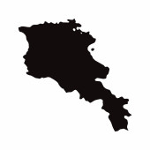
Armenia Map. Armenian Country Map. Black and White National Outline Boundary Border Shape Geography Territory EPS Vector Illustration Clipart

Informacje o pliku:
| Numer pliku: | 0102595072012 |
| Typ pliku/format: | Wektory ( ZIP ) |
| Rozdzielczość: | 5000x4000 (42,33x33,87 cm 300 dpi) |
| Kategorie: | |
| Autor: | xileodesigns |
| Zalecany program: | Adobe Illustrator |
podobne obrazy


ta sama seria


Ten sam autor
INFORMACJE O UŻYCIU:
Zdjęcie "Armenia Map. Armenian Country Map. Black and White National Outline Boundary Border Shape Geography Territory EPS Vector Illustration Clipart" może być wykorzystywane do celów osobistych i komercyjnych zgodnie z warunkami zakupionej licencji Royalty-free. Obraz jest dostępny do pobrania w jakości wysokiej rozdzielczości do 5760x3840.
Słowa kluczowe:
Zdjęcie.
biały
wektor
Kontekst
Grafika
ilustracja
projekt
Izolacja
kształt
znak
sztuka
szczegóły
Streszczenie
wycinanka
czarny
cięcie
sylwetka
granica
ikona
Klip
świat
obecnie
Szczegółowe informacje
azjatycki
kliparty
zarys
kraj
mapa
kartografia
geografia
obszar
krajowe
Azja
Położenie
laserowa
Republika
w regionie
Atlas
Grawerowanie
kalkomania
naród
armeński
Armenia
EPS
Tajski